Interaction Geography
Explore how people move and interact across space and time
What is Interaction Geography?
A Visual Language for Movement and Interaction
Trace movement from video, import tracking data, or load GPS routes — then visualize it alongside conversation, audio, and more.
Interaction Geography Slicer (IGS)
See movement and interaction unfold over time — animated paths reveal how people use and interact in a space
Movement Patterns
See how people move through space over time
Space & Place
Understand how the layout of a space shapes what happens inside it
Conversation Flow
Connect talk to place — see where dialogue happens and how conversations move
Multimodal Data
Layer video, transcripts, and movement together
How It Works
From Source Material to Visualization
Choose a pathway — whether you're starting with data or from scratch
Speculate
Draw and imagine movement over a floor plan or image — no data needed.
Video
Trace movement by hand from video using Mondrian, then visualize with IGS.
Indoor Tracking
Load position data from sensors or computer vision directly into IGS.
GPS
Import GPX, KML, or CSV from any GPS-enabled device — maps generated automatically.
Real-World Applications
See It in Action
Interaction Geography is being used across diverse settings, from classrooms to museums to virtual environments
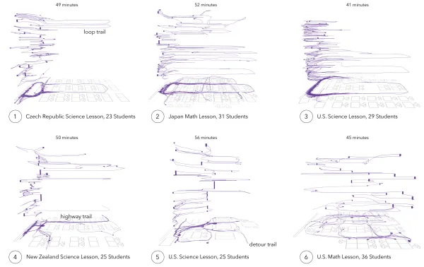
Classrooms
Explore secondary math teachers' movement and use of space across different classrooms and countries.
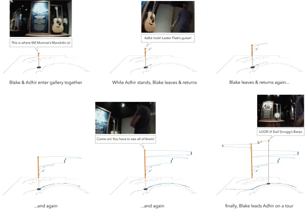
Museums
Visualize visitor interactions and movement patterns in a cultural heritage museum.
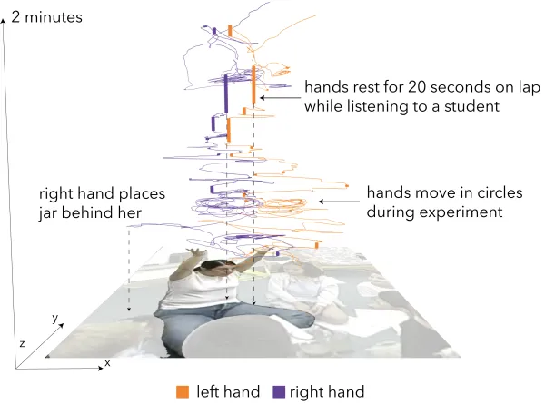
Early Childhood
Examine teacher and student gestures during elementary classroom activities.
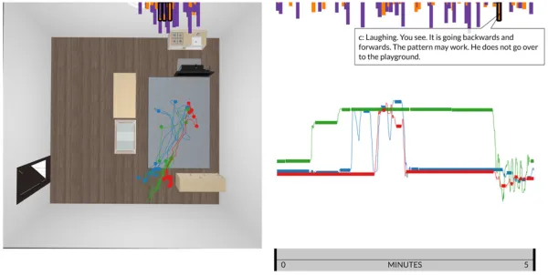
Computational Thinking
Visualize interactions between students, teachers, and robots in computational learning activities.